GEOENGINEERING
GEOENGINEERING
The new horizons of geology
There is the right choice and the effective choice, and when it comes to our clients, we always strive to combine both to achieve the most efficient option. With this mindset, we initiate and conclude every single project. In the complexity of the geo-engineering sector, the ability to address encountered challenges requires a multidisciplinary team like ours.
The technical experience gained by our geo-engineering team encompasses the fields of
- Geotechnics
- Geomechanics
- Hydraulics & Hydrogeology
- Geophysics

GEOTECHNICS
We approach geotechnics by identifying and conducting the necessary geognostic investigations to adopt the most efficient technical solutions and meet the requirements of the applicable standards. For testing, we rely on laboratories authorized by the Ministry of Infrastructure and Transport.


GEOMECHANICS
We study the stability, deformation, and strength conditions of rock masses, supported by advanced calculation software that allows us to determine the stability of rock slopes, the magnitude of potential collapses, and the identification of rock stability.
HYDROGEOLOGY AND HYDRAULIC STUDIES
We conduct flow tests to verify the response of aquifers. We implement water extraction systems from the subsurface using pumps (dewatering) with the aim of lowering the water table and enabling the construction of works below the groundwater level. Through numerical simulations using dedicated software (ModFlow, Surfer), we reconstruct contamination maps, monitor the functionality of dewatering systems, and open-loop geothermal plants.
Through one-dimensional free-surface flow and solid/flow transport studies, we classify flood-prone areas to identify future hazards. By classifying the area, we identify risks, and through surface water studies, we are able to intervene with mitigation works proposals.
Through one-dimensional free-surface flow and solid/flow transport studies, we classify flood-prone areas to identify future hazards. By classifying the area, we identify risks, and through surface water studies, we are able to intervene with mitigation works proposals.


GEOPHYSICS
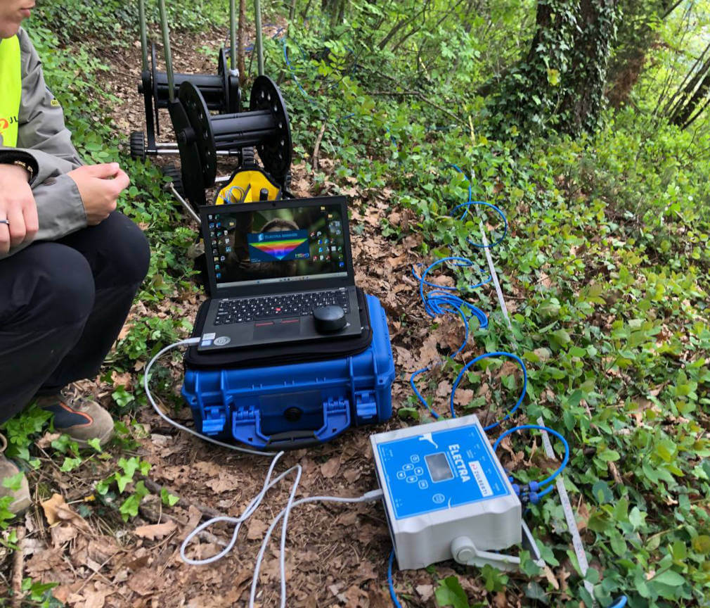
We perform non-invasive geognostic investigations that allow us to explore and reconstruct the geology of a site. Our advanced technologies, such as ground-penetrating radar and seismic and geoelectric surveys, enable us to obtain detailed images of the subsurface without the need for digging or drilling.
GEOTECHNICS
We approach geotechnics by identifying and conducting the necessary geognostic investigations to adopt the most efficient technical solutions and meet the requirements of the applicable standards. For testing, we rely on laboratories authorized by the Ministry of Infrastructure and Transport.


GEOMECHANICS
We study the stability, deformation, and strength conditions of rock masses, supported by advanced calculation software that allows us to determine the stability of rock slopes, the magnitude of potential collapses, and the identification of rock stability.
HYDROGEOLOGY AND HYDRAULIC STUDIES
We conduct flow tests to verify the response of aquifers. We implement water extraction systems from the subsurface using pumps (dewatering) with the aim of lowering the water table and enabling the construction of works below the groundwater level. Through numerical simulations using dedicated software (ModFlow, Surfer), we reconstruct contamination maps, monitor the functionality of dewatering systems, and open-loop geothermal plants.
Through one-dimensional free-surface flow and solid/flow transport studies, we classify flood-prone areas to identify future hazards. By classifying the area, we identify risks, and through surface water studies, we are able to intervene with mitigation works proposals.
Through one-dimensional free-surface flow and solid/flow transport studies, we classify flood-prone areas to identify future hazards. By classifying the area, we identify risks, and through surface water studies, we are able to intervene with mitigation works proposals.


GEOPHYSICS
We perform non-invasive geognostic investigations that allow us to explore and reconstruct the geology of a site. Our advanced technologies, such as ground-penetrating radar and seismic and geoelectric surveys, enable us to obtain detailed images of the subsurface without the need for digging or drilling.
REMEDIATION
GEOENGINEERING
OPERATION
Do you need a customized solution?

